
The best paper maps depend on whether you need road-trip detail, a regional reference, or a large wall display. My best overall pick is the Rand McNally 2027 Large Scale Road Atlas for its road-focused format and broad U.S. coverage; the National Geographic Adventure Edition is a stronger fit for travelers who want an outdoors-oriented atlas, while the Rand McNally Classic Edition U.S. Wall Map suits home planning. The main tradeoff is portability versus readability: folded maps pack small, atlases keep more information together, and wall maps give you room to view geography at a glance. Lamination adds protection but can make a map harder to mark or store. Continue reading for the full breakdown and a guide to choosing the right paper map for your needs.

Get furniture and decor delivered free — and shop member deals
- Fast, free delivery on millions of items
- Access to Prime Big Deal Days deals on October 6–7
- Prime Video, Amazon Music and more included
Complete the kit


Key Takeaways
- The Large Scale Road Atlas leads for general driving: Its atlas format and road-trip purpose make it a more practical starting point for broad U.S. travel than a wall map or single-region sheet.
- Atlas editions serve different trip styles: National Geographic’s Scenic Drives and Adventure editions frame travel around distinct interests, while Rand McNally’s Easy-to-Read Midsize Atlas favors a more approachable, less imposing format.
- Folded regional maps trade breadth for local focus: The Eastern and Western United States maps are easier to carry than wall maps, but each covers only part of the country.
- Wall maps are display and planning tools, not travel substitutes: The oversized Swiftmaps Elite map offers a different kind of legibility than the rolled Rand McNally maps, while the 24 x 36-inch world and U.S. set supports side-by-side geographic reference.
- Material and scale affect how a map gets used: Laminated wall maps suit frequent handling and display; paper maps may be easier to annotate, fold, or roll away, depending on the format.
| Rand McNally Classic Edition U.S. Wall Map, Paper, Rolled |  | Best for a Classic U.S. Wall Display | Map coverage: United States | Map format: Wall map | Material: Paper | VIEW LATEST PRICE | See Our Full Breakdown |
| Swiftmaps World Classic Premier Wall Map Poster, Laminated, 24 x 36 Inches |  | Best for a Markable World Map | Brand: Swiftmaps | Map type: Political and topographic world map | Dimensions: 24 x 36 inches | VIEW LATEST PRICE | See Our Full Breakdown |
| Rand McNally Easy to Read United States Map |  | Best for Readability-Focused U.S. Reference | Brand: Rand McNally | Map coverage: United States | Product type: United States map | VIEW LATEST PRICE | See Our Full Breakdown |
| Rand McNally Folded Map: Eastern United States |  | Best for Portable Eastern U.S. Coverage | Brand: Rand McNally | Map coverage: Eastern United States | Map format: Folded map | VIEW LATEST PRICE | See Our Full Breakdown |
| Swiftmaps Classic Elite Laminated United States Wall Map, 48 × 78 in | 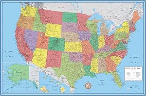 | Best for Large-Scale Planning and Teaching | Brand: Swiftmaps | Map type: Political | Map coverage: United States | VIEW LATEST PRICE | See Our Full Breakdown |
| National Geographic 2027 USA Road Atlas: Midsize Scenic Drives Edition |  | Best for Scenic Road Trips | Edition: Midsize Scenic Drives Edition | Year: 2027 | Coverage: United States | VIEW LATEST PRICE | See Our Full Breakdown |
| Rand McNally 2027 Large Scale Road Atlas |  | Best for Large-Scale Road Reference | Brand: Rand McNally | Publication year: 2027 | Product type: Road atlas | VIEW LATEST PRICE | See Our Full Breakdown |
| Swiftmaps Contemporary 3D World and USA Wall Map Set, 24 × 36 Inches, Laminated |  | Best Two-Map Wall Set | Brand: Swiftmaps | Map type: Topographic | Set size: 2 maps | VIEW LATEST PRICE | See Our Full Breakdown |
| National Geographic Adventure Map: Pacific Northwest, United States (Map 3118) |  | Best Regional Adventure Map | Brand: National Geographic | Product type: Adventure Map | Region: Pacific Northwest, United States | VIEW LATEST PRICE | See Our Full Breakdown |
| Rand McNally Signature Edition U.S. Wall Map, Paper, Rolled |  | Best Traditional Paper Wall Map | Brand: Rand McNally | Edition: Signature Edition | Coverage: United States | VIEW LATEST PRICE | See Our Full Breakdown |
| Rand McNally Folded Map: Western United States | 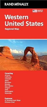 | Best Regional Folded Map | Format: Folded map | Coverage: Western United States | Product name: Rand McNally Folded Map: Western United States | VIEW LATEST PRICE | See Our Full Breakdown |
| National Geographic 2027 USA Road Atlas: Adventure Edition |  | Best for Adventure-Minded U.S. Road Trips | Brand: National Geographic | Year: 2027 | Edition: Adventure Edition | VIEW LATEST PRICE | See Our Full Breakdown |
| Rand McNally 2027 Easy-to-Read Midsize Road Atlas |  | Best for Readability in a Midsize Atlas | Brand: Rand McNally | Year: 2027 | Product type: Midsize road atlas | VIEW LATEST PRICE | See Our Full Breakdown |
| paper map | Brand | Product type | ASIN |
|---|---|---|---|
| Rand McNally Classic Edition U | Rand McNally | — | — |
| Swiftmaps World Classic Premie | Swiftmaps | — | — |
| Rand McNally Easy to Read Unit | Rand McNally | United States map | — |
| Rand McNally Folded Map: Easte | Rand McNally | Regional map | — |
| Swiftmaps Classic Elite Lamina | Swiftmaps | — | — |
| National Geographic 2027 USA R | — | Road atlas | 1566957060 |
| Rand McNally 2027 Large Scale | Rand McNally | Road atlas | 0528029509 |
| Swiftmaps Contemporary 3D Worl | Swiftmaps | — | — |
| National Geographic Adventure | National Geographic | Adventure Map | 1566957125 |
| Rand McNally Signature Edition | Rand McNally | Wall map | 0528012746 |
| Rand McNally Folded Map: Weste | — | — | 0528028669 |
| National Geographic 2027 USA R | National Geographic | Road atlas | 0792289897 |
| Rand McNally 2027 Easy-to-Read | Rand McNally | Midsize road atlas | 0528029517 |
More Details on Our Top Picks
Rand McNally Classic Edition U.S. Wall Map, Paper, Rolled
The Rand McNally Classic Edition is a straightforward choice for buyers who want a United States map to hang on a wall without opting for a coated, dry-erase surface. Its paper format arrives rolled, which can be easier to store before display than a folded map, though the available details do not specify dimensions or map features. Compared with the much larger, laminated Swiftmaps Classic Elite Laminated United States Wall Map, this is the simpler, less feature-specific wall-map option: it avoids a stated oversized footprint, but also lacks a listed protective finish for marking or frequent handling. Choose it when a traditional paper presentation matters more than write-on functionality. I would skip it if you need verified dimensions, detailed map coverage, or a durable surface for repeated annotations.
Pros:- Provides a dedicated United States wall-map format.
- Paper construction offers a traditional, non-laminated presentation.
- Rolled packaging avoids arriving as a folded map.
Cons:- Dimensions and specific map details are not provided.
- No laminated or dry-erase finish is listed for repeated marking.
- Rolled paper may need flattening before it hangs neatly.
Best for: Buyers seeking a traditional rolled paper map of the United States for a home or office wall display.
Not ideal for: Teachers, planners, or frequent map annotators who need a specified size and a laminated dry-erase surface.
- Map coverage:United States
- Map format:Wall map
- Material:Paper
- Packaging:Rolled
- Edition:Classic Edition
- Brand:Rand McNally
Our verdict“Choose this for a simple rolled-paper U.S. wall display, but pick the Swiftmaps Classic Elite if you need a large, markable surface.”
Swiftmaps World Classic Premier Wall Map Poster, Laminated, 24 x 36 Inches
The Swiftmaps World Classic Premier combines global political and topographic information in a 24 x 36-inch laminated poster. Shaded relief across land and oceans adds geographic context that a plain political map may not provide, while the UV-coated surface supports dry-erase use for lessons or planning. That makes it more interactive than the paper-only Rand McNally Classic Edition U.S. Wall Map, though the two serve different purposes: this one covers the world and invites annotation, while Rand McNally focuses on the United States. Its wall-ready footprint is substantial enough to check before ordering, but it is far less expansive than Swiftmaps’ 48 x 78-inch U.S. wall map. The tradeoff is a single global view rather than detailed regional coverage.
Pros:- Combines political and topographic world-map information.
- Shaded terrain relief gives visual context to land and ocean features.
- UV-coated laminated surface supports dry-erase marking.
- 24 x 36-inch dimensions are specified for wall-space planning.
Cons:- The 24 x 36-inch poster still needs a sizeable clear wall area.
- World coverage gives less room for regional detail than a focused U.S. map.
- The listed description does not specify a mounting method.
Best for: Teachers, students, and households wanting a world map they can annotate with dry-erase markers.
Not ideal for: Buyers with limited wall space or travelers who need a portable regional map rather than a display poster.
- Brand:Swiftmaps
- Map type:Political and topographic world map
- Dimensions:24 x 36 inches
- Material:24 lb paper
- Finish:Laminated, UV-coated
- Surface use:Dry-erase compatible
- Item weight:2.08 ounces
- Quantity:1
Our verdict“Pick this for an annotatable world overview with terrain relief; choose the Rand McNally Classic Edition for an uncoated U.S.-focused display.”
Rand McNally Easy to Read United States Map
The Rand McNally Easy to Read United States Map is the most direct fit here for buyers who prioritize legibility in a U.S. map: readability is the defining feature in its name, though the product details do not provide a scale, format, dimensions, or specific design features. That makes it a less certain wall-display choice than the Rand McNally Classic Edition U.S. Wall Map, which at least specifies paper construction and rolled packaging. It also differs from the laminated Swiftmaps Classic Elite, whose large size and dry-erase surface suit group reference and annotation. I would select this Rand McNally option when a clear U.S. reference is the priority, but the sparse specifications make it hard to judge portability, hanging suitability, or marking durability before buying.
Pros:- United States coverage is explicitly identified.
- Readability is the product’s stated point of distinction.
- Offers a focused national reference rather than a world overview.
Cons:- Format and dimensions are not provided.
- No material or protective finish is specified.
- Available details do not describe the map’s scale or included geographic features.
Best for: Readers seeking a United States map with readability as the stated priority, especially for straightforward reference.
Not ideal for: Buyers who need confirmed dimensions, a specified folded or wall format, or a laminated surface for annotations.
- Brand:Rand McNally
- Map coverage:United States
- Product type:United States map
- Stated emphasis:Easy to read
- Format:Not specified
- Material:Not specified
Our verdict“Consider this for a readability-led U.S. reference, but choose a product with fuller specifications if format or wall display matters.”
Rand McNally Folded Map: Eastern United States
The Rand McNally Folded Map: Eastern United States earns its place through a practical distinction: it is a folded, region-specific paper map rather than a wall poster or broad national display. That format should suit travelers who want Eastern U.S. coverage in a package they can carry, while the Rand McNally Folded Map: Western United States is the natural counterpart for trips in the other half of the country. Compared with the Rand McNally Easy to Read United States Map, this option clearly states both its region and folded format, although the available details do not establish its scale, dimensions, or included roads and places. Its narrower coverage is useful for focused travel planning but less suitable as a single reference for coast-to-coast trips.
Pros:- Specifies Eastern United States coverage.
- Folded format is suited to carrying and storing away between uses.
- Provides a regional alternative to a full U.S. wall map.
- Pairs naturally with a western-region map for broader trip coverage.
Cons:- Regional coverage does not serve as a complete U.S. reference.
- Scale, dimensions, and included geographic details are not provided.
- Folds may be less convenient than a flat display for group planning.
Best for: Travelers planning routes within the Eastern United States who want a folded map instead of a wall display.
Not ideal for: People planning cross-country trips or buyers who need a map with published dimensions, scale, or specific feature details.
- Brand:Rand McNally
- Map coverage:Eastern United States
- Map format:Folded map
- Product type:Regional map
- Material:Not specified
- Dimensions:Not specified
Our verdict“Choose this for portable trip reference in the Eastern United States; pick a national map for coast-to-coast planning.”
Swiftmaps Classic Elite Laminated United States Wall Map, 48 × 78 in
The Swiftmaps Classic Elite is the lineup’s most expansive U.S. wall option, with a 48 x 78-inch political map and a laminated, dry-erase-compatible surface. At this scale, it suits classrooms, offices, or planning spaces where several people need to read and mark the map together. The coating also gives it a practical advantage over the paper-only Rand McNally Classic Edition U.S. Wall Map, which is the more traditional choice but has no listed marking surface. Compared with Swiftmaps’ 24 x 36-inch world poster, this map devotes far more wall area to the United States rather than global coverage. The payoff is visibility and annotation space; the cost is a very large display footprint that will not suit every room.
Pros:- Large 48 x 78-inch format supports viewing from across a room.
- Laminated surface is compatible with dry-erase marking.
- Political U.S. map suits shared reference and planning.
- Specified for home, business, and educational display.
Cons:- Requires a substantial uninterrupted wall area.
- Large display format is not convenient for travel or compact storage.
- The listing does not provide details about map scale or specific geographic features.
Best for: Teachers, offices, and households with ample wall space that need a large, reusable U.S. map for group reference.
Not ideal for: Apartment dwellers or travelers seeking a portable map, since the 48 x 78-inch format is designed for display.
- Brand:Swiftmaps
- Map type:Political
- Map coverage:United States
- Dimensions:48 x 78 inches
- Weight:12 ounces
- Finish:Coated
- Surface:Laminated, dry-erase compatible
- Color description:48 x 78 laminated
Our verdict“Choose this for a spacious classroom or planning area that needs a large, markable U.S. map; opt for the 24 x 36-inch Swiftmaps poster when wall space is tighter.”
National Geographic 2027 USA Road Atlas: Midsize Scenic Drives Edition
The Midsize Scenic Drives Edition is the clearest fit here for travelers who want a paper atlas to help shape the journey, not just connect highways. Its United States coverage gives road-trippers a national reference, while the scenic-drive focus points it toward route inspiration. Compared with the Rand McNally 2027 Large Scale Road Atlas, this title’s stated emphasis is more about finding a scenic way through a trip than relying on a general road atlas. The tradeoff is limited available detail: the product data does not specify scale, map features, binding, or dimensions, so buyers cannot judge readability or handling against the large-scale Rand McNally. Choose it for its stated subject and coverage, but skip it if you need confirmed detail about map scale or construction before buying.
Pros:- Scenic-drive focus suits travelers seeking route inspiration
- United States coverage supports trips across regions
- 2027 edition identifies the publication year
Cons:- No scale, binding, or physical dimensions are provided
- The available details do not describe specific map features or route coverage
Best for: Road-trippers planning drives across multiple U.S. regions who want an atlas specifically focused on scenic routes.
Not ideal for: Drivers who need confirmed scale, detailed map features, or atlas dimensions before choosing a road reference.
- Edition:Midsize Scenic Drives Edition
- Year:2027
- Coverage:United States
- Product type:Road atlas
- ASIN:1566957060
- Stated focus:Scenic drives
Our verdict“Choose this atlas if scenic-drive planning is your priority; pick the Rand McNally 2027 Large Scale Road Atlas if its large-scale format better matches your map-reading needs.”
Rand McNally 2027 Large Scale Road Atlas
The large-scale format is the defining reason to choose this 2027 road atlas: it is aimed at readers who value a more expansive map presentation over a compact, easy-to-stow reference. Against the National Geographic 2027 USA Road Atlas: Midsize Scenic Drives Edition, Rand McNally’s title foregrounds scale rather than scenic routes, making the two better suited to different kinds of trip planning. Its U.S. road-atlas format gives it a broad role, but the supplied product details do not confirm dimensions, binding, map scale, or specific contents. That leaves practical questions unanswered, especially for buyers deciding how easily it will fit in a vehicle or how much detail its maps show. Pick it for the large-scale positioning; skip it if you need verified construction or feature details.
Pros:- Large-scale positioning favors readers who prefer an expansive map presentation
- Road-atlas format serves as a broad trip-planning reference
- 2027 publication year is specified
Cons:- No physical dimensions or binding details are supplied
- Specific map contents and scale are not described
Best for: Drivers who want a 2027 U.S. road atlas explicitly positioned around large-scale maps for route reading.
Not ideal for: Travelers who need a compact atlas or confirmed information about dimensions, scale, binding, and included map features.
- Brand:Rand McNally
- Publication year:2027
- Product type:Road atlas
- Stated format:Large scale
- Coverage:Not specified in supplied product data
- ASIN:0528029509
Our verdict“Choose this Rand McNally if large-scale road maps are your priority, but compare its unprovided size and feature details before settling on it over a more specifically described atlas.”
Swiftmaps Contemporary 3D World and USA Wall Map Set, 24 × 36 Inches, Laminated
This set stands apart by pairing a world map and U.S. map rather than focusing on one paper reference. Each 24 × 36-inch map uses 3D-style terrain relief, giving wall viewers a visual sense of landforms that the rolled, single-country Rand McNally Signature Edition U.S. Wall Map does not promise. The glossy laminate also makes the surfaces dry-erase compatible, useful for marking lessons, travel ideas, or planning notes without treating the maps as one-use prints. The cost of that versatility is space: two large maps need substantial wall area, and the glossy laminated look may not suit buyers seeking a traditional, uncoated paper map. Choose this set for display and repeated annotation, not for a portable road-trip reference.
Pros:- Includes separate world and United States maps
- Laminated surfaces support dry-erase marking
- 3D-style terrain relief adds visual landform context
- Each map measures 24 × 36 inches
Cons:- Two maps at 24 × 36 inches each require substantial wall space
- Glossy laminated finish is less suited to buyers wanting an uncoated paper map
- Wall-map format is not a portable navigation option
Best for: Teachers, families, and trip planners who have wall space for both a world map and a U.S. map and want to mark them repeatedly.
Not ideal for: Travelers needing a map to carry on the road, or buyers seeking a single, unlaminated paper wall map.
- Brand:Swiftmaps
- Map type:Topographic
- Set size:2 maps
- Dimensions:24 × 36 inches each
- Paper:100 lb
- Finish:Glossy laminated
- Features:3D-style visual terrain relief; dry-erase compatible
- Model number:SM WLD USA CONT EL
Our verdict“Choose this set for an annotatable world-and-U.S. wall display; choose the Rand McNally Signature Edition U.S. Wall Map if you want a single rolled paper map instead.”
National Geographic Adventure Map: Pacific Northwest, United States (Map 3118)
The Pacific Northwest coverage gives this National Geographic title a distinct job in the lineup: serving travelers focused on one U.S. region, rather than providing nationwide atlas coverage. That makes it a more targeted choice than the National Geographic 2027 USA Road Atlas: Midsize Scenic Drives Edition, whose stated coverage spans the United States and whose focus is scenic drives. The Adventure Map name suggests a regional travel role, but the supplied details do not identify scale, included locations, material, folding format, or specific outdoor features. Buyers should not assume those details from the title alone. Pick this map when the Pacific Northwest is your destination and regional focus matters more than national coverage; skip it if you need a fully specified hiking or road-navigation tool.
Pros:- Focused coverage serves trips centered on the Pacific Northwest
- Adventure Map designation distinguishes it from general U.S. atlas options
- Map number 3118 identifies the specific map
Cons:- Coverage is regional rather than nationwide
- Scale, format, material, and mapped features are not supplied
Best for: Travelers planning trips centered on the Pacific Northwest who prefer a region-specific paper map over a national atlas.
Not ideal for: Buyers seeking nationwide coverage or needing confirmed scale, terrain detail, material, and format before purchasing.
- Brand:National Geographic
- Product type:Adventure Map
- Region:Pacific Northwest, United States
- Map number:3118
- Coverage:Pacific Northwest, United States
- ASIN:1566957125
Our verdict“Choose Map 3118 for a Pacific Northwest-focused trip, but select the National Geographic 2027 USA Road Atlas if you need broader U.S. coverage.”
Rand McNally Signature Edition U.S. Wall Map, Paper, Rolled
This is the straightforward choice for buyers who want a single U.S. wall map on paper, without a laminate finish or a second map in the set. Its rolled format suits display planning and storage better than a folded road map, while the Signature Edition label distinguishes it from the Swiftmaps Contemporary 3D World and USA Wall Map Set, which adds world coverage, lamination, and dry-erase use. That simpler paper presentation is also the tradeoff: it is not described as erasable or laminated, and the supplied details give no dimensions, scale, or map features. I would choose it for a conventional U.S. wall reference where paper matters more than annotation or terrain effects. Skip it if you need confirmed size or a surface built for repeated marking.
Pros:- Paper material suits buyers who prefer a traditional map surface
- Rolled format is suited to wall display
- U.S. coverage keeps the map focused on one country
Cons:- No dimensions or map scale are provided
- Paper format is not described as laminated or dry-erase compatible
- Includes only U.S. coverage, unlike the Swiftmaps world-and-U.S. set
Best for: Home, office, or classroom buyers who want one rolled paper map of the United States for wall display.
Not ideal for: People who need a dry-erase surface, a world map alongside the U.S. map, or confirmed dimensions and scale.
- Brand:Rand McNally
- Edition:Signature Edition
- Coverage:United States
- Material:Paper
- Format:Rolled
- Product type:Wall map
- ASIN:0528012746
Our verdict“Choose this map for a traditional, single-country paper display; pick the Swiftmaps set if you want lamination, write-on use, or world coverage.”
Rand McNally Folded Map: Western United States
I’d choose this map when my trip centers on the western United States and I want a single sheet rather than a bound atlas. Its regional coverage gives it a narrower job than the nationwide Rand McNally 2027 Easy-to-Read Midsize Road Atlas: it suits travelers planning around western states, while the atlas is the more flexible choice for routes that cross the country. The folded format is easier to carry than a wall map, but it still has to be opened and refolded during use, and the supplied details don’t specify its scale, paper finish, or state-level coverage. I’d pick it for a defined regional itinerary, not as a substitute for a road atlas when plans span several regions.
Pros:- Regional coverage focuses on the western United States
- Folded sheet format is more portable than a wall map
- A straightforward alternative to carrying a nationwide atlas for a western-only trip
Cons:- Coverage is limited to the western United States
- A single folded sheet may be less convenient to consult repeatedly than a bound atlas
- Product data does not specify scale, paper finish, or the states included
Best for: Road-trippers whose routes stay within the western United States and who prefer a portable paper sheet to an atlas.
Not ideal for: Travelers crossing multiple U.S. regions or anyone who needs documented scale, material, or detailed coverage information before buying.
- Format:Folded map
- Coverage:Western United States
- Product name:Rand McNally Folded Map: Western United States
- ASIN:0528028669
- Map type:Regional paper map
- Paper finish:Not specified in supplied product data
Our verdict“Choose this folded map for a western-focused road trip; choose a nationwide atlas if your route extends beyond the region.”
National Geographic 2027 USA Road Atlas: Adventure Edition
The Adventure Edition gives this National Geographic atlas a clear audience: travelers who want a bound paper road atlas for trips around the United States and are drawn to an adventure-oriented edition. Compared with the Rand McNally Folded Map: Western United States, its stated nationwide scope is better suited to long itineraries that cross regional boundaries, while the folded map is the more focused choice for western travel. The supplied details confirm the 2027 edition and that it is a road atlas, but don’t describe its map scale, included routes, binding, or other adventure-specific content. That lack of detail makes it harder to choose over the Rand McNally 2027 Easy-to-Read Midsize Road Atlas if legibility is your main priority. I’d select it for its stated scope and edition, not on unverified feature assumptions.
Pros:- Covers the United States
- Road atlas format gathers maps in a bound-style reference rather than a single regional sheet
- Identified as the 2027 edition
- Adventure Edition gives the product a distinct stated positioning
Cons:- Supplied data does not describe its adventure-specific maps or content
- Map scale and readability details are not provided
- No format dimensions, binding, or paper details are supplied
Best for: Adventure-oriented travelers planning road trips across the United States who want a 2027 paper road atlas.
Not ideal for: Buyers who need confirmed details about map scale, specific adventure routes, binding, or readability before choosing an atlas.
- Brand:National Geographic
- Year:2027
- Edition:Adventure Edition
- Coverage:United States
- Product type:Road atlas
- ASIN:0792289897
Our verdict“Pick this atlas if you want a 2027 nationwide road reference with an adventure-oriented edition, but verify its map details if specific features matter.”
Rand McNally 2027 Easy-to-Read Midsize Road Atlas
I’d put this Rand McNally atlas on the shortlist when map readability matters more than having a single regional sheet. Its midsize road-atlas format and easy-to-read positioning offer a different appeal from the Rand McNally Folded Map: Western United States, which concentrates on one region rather than presenting itself as an atlas. Compared with the National Geographic 2027 USA Road Atlas: Adventure Edition, this pick has a clearer stated benefit for readers who prioritize legible maps; the National Geographic title instead emphasizes its Adventure Edition. The tradeoff is that the supplied data gives no dimensions, specific coverage details, scale, or explanation of what makes the maps easier to read. I’d favor it for general atlas use where that stated readability matters, but buyers needing precise size or map specifications should check those details first.
Pros:- Designed with easy-to-read maps
- Midsize road atlas format provides an atlas alternative to a folded regional map
- Identified as the 2027 edition
Cons:- Supplied product data does not state dimensions or map scale
- Specific geographic coverage is not detailed beyond the road-atlas description
- The source does not explain how its readability differs from other atlases
Best for: Drivers who want a 2027 midsize road atlas and prioritize easy-to-read maps for planning and checking routes.
Not ideal for: Travelers who need a compact single-region sheet, or buyers who require confirmed dimensions, scale, and detailed coverage before purchase.
- Brand:Rand McNally
- Year:2027
- Product type:Midsize road atlas
- Map readability:Designed for easy-to-read maps
- Format:Road atlas
- ASIN:0528029517
Our verdict“Choose this atlas if easy-to-read maps are your priority, and choose a folded regional map if you want a more focused sheet for one part of the country.”

How We Picked
I compared these 13 products by the job each map is built to do: route planning, regional travel, road-trip reference, or wall display. For travel maps, I prioritized useful coverage, ease of reading while planning, and whether the format makes sense to carry. For wall maps, I focused on viewing scale, display dimensions, material, and how well the map suits quick reference. I also treated atlas editions and folded maps as different tools rather than ranking them as interchangeable choices.
The order reflects versatility for the broadest set of buyers first, followed by specialized options whose strengths depend on a particular use. A national road atlas ranks ahead of a single-region map for travelers crossing state lines, while a large wall map can be the better choice for a home or classroom despite being impractical on the road. I weighed the tradeoffs of size, format, and lamination alongside each product’s stated purpose, and did not treat a larger or more feature-rich map as automatically better.
| paper map | Brand | Product type |
|---|---|---|
| Rand McNally Classic Edition U | Rand McNally | — |
| Swiftmaps World Classic Premie | Swiftmaps | — |
| Rand McNally Easy to Read Unit | Rand McNally | United States map |
| Rand McNally Folded Map: Easte | Rand McNally | Regional map |
| Swiftmaps Classic Elite Lamina | Swiftmaps | — |
| National Geographic 2027 USA R | — | Road atlas |
| Rand McNally 2027 Large Scale | Rand McNally | Road atlas |
| Swiftmaps Contemporary 3D Worl | Swiftmaps | — |
| National Geographic Adventure | National Geographic | Adventure Map |
| Rand McNally Signature Edition | Rand McNally | Wall map |
| Rand McNally Folded Map: Weste | — | — |
| National Geographic 2027 USA R | National Geographic | Road atlas |
| Rand McNally 2027 Easy-to-Read | Rand McNally | Midsize road atlas |
Factors to Consider When Choosing Best Paper Maps
Before choosing among the best paper maps, decide where you will use one and what you need to see at a glance. The right format can matter as much as geographic coverage: an atlas, folded sheet, and wall map solve different problems.
Choose the format around the task
A road atlas gathers many map pages into one book, which suits travelers planning a route across several states. A folded regional map keeps one area in a single sheet, making it handy when your trip stays within its coverage. Wall maps are useful for household planning, teaching, or seeing broad geographic relationships without flipping pages. A common mistake is buying a wall map for in-car use or expecting a compact folded map to show the same breadth as an atlas. Decide whether you will carry, consult, display, or mark the map before comparing specific editions.
Match coverage to the journey
National coverage is helpful for long-distance trips, but a regional map can devote its space to an area you know you will explore. If your plans cross state lines, a single-region sheet may leave gaps that require another map or a separate reference. For local trips, broad coverage can mean carrying more map than you need without gaining useful detail for the destination. Check the named region and intended travel focus rather than assuming that every U.S. map offers the same level of road detail. Scenic-drive and adventure themes can guide trip inspiration, but they do not replace checking whether the map covers your actual route.
Balance scale with portability
Larger map formats can make labels and geographic features easier to inspect, but they take more space to store, carry, or display. Midsize atlases and folded maps are easier to bring along, though smaller pages may require closer attention when comparing routes. Wall maps make sense when several people need to view the same area at once; they are less convenient for quick roadside consultation. Avoid choosing by dimensions alone: the useful question is whether the scale and format make the information readable in the place you plan to use it. If you will move between a car, home, and campsite, portability may matter more than maximum display size.
Decide whether lamination fits your use
Lamination can help a map withstand repeated handling and make a displayed surface easier to wipe clean. It can also make folding or rolling less convenient, depending on the map’s construction, and may not suit people who want to write directly on the paper. Unlaminated paper can be easier to annotate and store in a familiar folded or rolled format, but it may need gentler handling. Do not assume lamination makes a map suitable for every outdoor condition; it does not automatically make a paper map waterproof or indestructible. Choose the finish based on where the map will live and how often you expect to handle it.
Treat readability as a practical feature
Readability depends on more than the map’s overall size: label density, page layout, and viewing distance all shape how quickly you can find information. Easy-to-read formats may be more comfortable for casual route planning, while a larger wall map can help several people scan a broader area together. A detailed map that is difficult for you to read may be less useful than a simpler layout that supports quick decisions. If you have trouble with small print, favor a larger presentation or a format explicitly designed for easier reading. Think about whether you will study the map at a table, hold it in a vehicle, or view it from across a room.
Pay for specialization only when you need it
Specialized editions can make a better match for a particular trip style, but their extra focus may offer little benefit for general reference. An adventure-oriented atlas is a natural candidate for outdoor-minded travel, while a scenic-drives edition may appeal to people planning routes for the journey as well as the destination. A 3D wall map set can add visual context, but it is a display choice rather than a substitute for a road atlas. The common mistake is choosing a themed or premium presentation before confirming that its coverage and format suit the intended task. Start with your trip or display need, then decide whether the specialized features add value for you.
Frequently Asked Questions
Should I choose a road atlas or a folded regional map for a multi-state trip?
For a trip crossing several states, an atlas is usually the more practical single purchase because it collects broad coverage in one portable reference. A folded regional map can be easier to handle when most of your route stays within one area, but it may not cover the full journey. Some travelers prefer an atlas for the main route and a regional map for closer planning at their destination. Check the actual coverage and format before choosing, especially if you want one map to cover every leg. Neither format replaces checking current road conditions or closures.
Is a laminated paper map a good choice if I want to write notes on it?
It depends on the surface and the kind of marking you plan to do. A laminated map may be easier to wipe clean, but ordinary pens may not work well or may leave marks that are difficult to remove. Unlaminated paper is often a more straightforward choice for penciled notes, route lines, and trip annotations, though it can show wear sooner. If annotation is central to your use, check the product’s surface details and confirm which writing tools are suitable. You may also want to keep a separate notebook rather than mark a map you plan to preserve.
Can a wall map replace an atlas for planning a road trip?
A wall map can help you understand the broad shape of a route, compare regions, and discuss plans with other people. It is less suited to carrying on a trip or consulting for page-by-page road detail. An atlas is usually the stronger companion when you need a portable format with road-focused coverage across many areas. For home planning, the two formats can complement one another: use the wall map for the big picture and an atlas for route decisions. If you can buy only one, choose based on where you will consult it most.
Which kind of paper map makes the most sense for a first-time road-trip planner?
A road atlas is a straightforward starting point for someone planning a trip across multiple states because it puts broad coverage into one reference. A midsize or easy-to-read format may feel less cumbersome than a larger atlas if you expect to consult it at a table or in a car. If the first trip is limited to one region, a folded regional map can be simpler to manage. Focus on how comfortably you can find routes and follow the map layout, rather than choosing the edition with the most specialized theme. Paper maps work best as planning and backup tools alongside up-to-date information about road conditions.
What should I check before buying a paper map as a gift?
Start with the recipient’s likely use: a traveler, an outdoor enthusiast, and someone decorating a room need different formats. Confirm whether they would prefer a carryable atlas, a focused regional sheet, or a map made for display. For a wall map, check the dimensions and whether its finish suits the room and handling habits; for travel, focus on coverage and portability. A themed edition is a thoughtful fit when it matches an established interest, but broad coverage is safer when you do not know the exact trip. If the recipient already has a favorite map format, matching it may matter more than adding a new style.
Conclusion
For most travelers, my best overall recommendation is the Rand McNally 2027 Large Scale Road Atlas, which puts road-trip use and broad U.S. coverage ahead of display features. For a focused trip, the best value in format is a Rand McNally folded map for the Eastern or Western United States, chosen to match your route. The best premium wall-display pick is the oversized Swiftmaps Classic Elite Laminated U.S. Wall Map; choose it for a prominent reference surface, not for portability. Beginners may prefer the Rand McNally 2027 Easy-to-Read Midsize Road Atlas for a more approachable atlas format, while outdoor-minded travelers should look at the National Geographic Adventure Edition or the Pacific Northwest Adventure Map for regional focus. If scenic route inspiration is the priority, the National Geographic Scenic Drives Edition is the more targeted fit; for side-by-side world and U.S. viewing, choose the Swiftmaps 3D map set. Pick the format that matches where and how you will use it, then narrow the choice by coverage and finish.
Fall Picks
fall essentials
As an affiliate, we earn on qualifying purchases.